Rivers: last line of defence for biodiversity, livelihood

- Update Time : Sunday, September 27, 2026
- 5 Time

WHEN a river dries up, more than water disappears. An ecosystem is disrupted, food chains weaken, livelihoods are affected, and the ecological vitality of an entire landscape is put at risk. Bangladesh’s identity is inseparable from its rivers and wetlands. From the Padma, the Jamuna and the Meghna to the Surma-Kushiyara and countless smaller rivers, canals, beels, haors, baors and floodplains, the country has evolved around a vast and interconnected aquatic landscape. Yet, the existence of a river on a map does not necessarily mean that it remains ecologically alive. In many places, river flows have declined, canals have been filled or disconnected, wetlands have been fragmented, and roads, embankments, culverts and other infrastructure have altered the natural movement of water.
Active and natural water flow is indispensable to long-term biodiversity conservation. Biodiversity is often discussed in terms of forests, wildlife, birds, fish or individual endangered species. Yet, these species do not exist in isolation. Fish, aquatic plants, amphibians, reptiles, water birds, insects, microorganisms and millions of people whose livelihoods depend on aquatic resources are connected through complex ecological relationships. A river connects with canals, canals with beels and beels with floodplains. During the monsoon, water, nutrients, sediments and aquatic organisms move through this network. During the dry season, water levels fall and many species move into deeper channels and permanent water bodies. This seasonal rhythm is part of the ecosystem. When connectivity is broken, biodiversity suffers.
One of the weaknesses in our development approach is that rivers are often treated as channels for transporting or draining water rather than as living ecosystems. A river’s flow provides migration routes for fish, transports sediment and nutrients, sustains wetlands, supports groundwater interactions and creates habitats for a wide range of organisms. When rivers are excessively embanked, blocked, straightened, encroached upon or disconnected from their floodplains, the consequences extend beyond changes in water levels. Fish breeding grounds can disappear, waterbird feeding areas can shrink, aquatic vegetation can decline, and communities dependent on rivers and wetlands can lose traditional livelihoods.
Development is necessary, but infrastructure planning must consider more than engineering feasibility, land and financial costs. It must also account for impacts on water connectivity and biodiversity. The concept of environmental flow is particularly relevant here. It does not mean maintaining the same volume of water in a river throughout the year. Natural rivers change with the seasons. Floods, recession of floodwaters, sediment movement and seasonal connectivity all contribute to their ecological functions. For many fish species, higher water levels at particular times are essential for migration and reproduction. Some aquatic plants depend on specific water conditions, while many water birds rely on shallow wetlands and exposed mudflats that emerge as water levels decline.
Water, therefore, has a rhythm as well as a quantity. Disrupting that rhythm may not immediately dry up a river, but it can gradually undermine its ecological productivity. Bangladesh’s Hakaluki Haor provides an important example. Research has found that connectivity between rivers, canals and beels is closely associated with fish movement, breeding and production. Sedimentation has reduced the depth and functionality of some wetlands, while changes in connectivity can restrict fish movement between rivers and floodplain habitats. Maintaining effective river-wetland connections is consequently important for fisheries and biodiversity. A beel has to be understood in relation to its wider water network: where its water comes from, where it goes, when fish enter it, where they breed and how they return to permanent water bodies.
Tanguar Haor offers another example. It is internationally recognised as a Ramsar wetland and is also designated as an Ecologically Critical Area. Research has documented substantial fish diversity in the haor while identifying pressures including overexploitation, sedimentation, pollution, climatic changes and infrastructure-related disruption. Where roads, embankments or culverts obstruct natural water movement, they can interfere with fish migration and recruitment. The environmental impact of infrastructure can therefore extend well beyond the physical footprint of a project. A culvert may be a small engineering structure, but if it blocks the connection between a river and a floodplain wetland, its ecological effects can spread across a much wider area.
The Sunderbans demonstrates the same interdependence at a larger scale. It is a dynamic estuarine ecosystem shaped by rivers, tidal channels, freshwater flows, sediment movement and salinity. Changes in freshwater availability and the balance between fresh and saline water influence the conditions on which vegetation and wildlife depend. Protecting the Sunderbans, therefore, also requires attention to the river systems outside the forest boundary. Its ecological security is linked to the wider hydrological system.
The same applies to Bangladesh’s haors, beels and floodplains. A wetland may still contain water, but if its natural connections with rivers and canals have been severed, its ecological function can change dramatically. A wetland without connectivity may remain on a government map while gradually losing the biological processes that once made it productive. Filling a canal is consequently more than a land-use violation. A canal may carry water during the monsoon, provide a migration route for fish, drain excess water from agricultural land and connect a wetland with a larger river system. Its value cannot be measured simply by the price of the land gained by filling it.
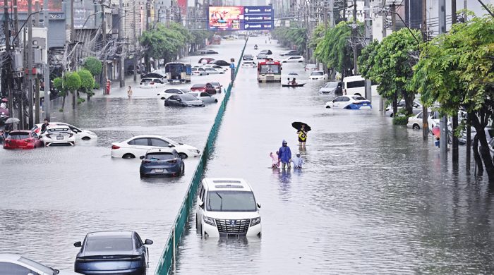
Climate change makes the issue more pressing. Bangladesh is increasingly exposed to extreme rainfall, prolonged waterlogging, drought, heat stress and salinity. Healthy rivers and wetlands can function as natural infrastructure under these conditions. Wetlands temporarily store excess water, connected waterways improve drainage and natural hydrological systems support groundwater recharge and ecosystem resilience. Filling wetlands, blocking canals and constricting rivers weakens these natural buffers. When waterlogging or flooding occurs, land-use decisions, infrastructure design and water management must therefore also be examined alongside climatic factors.
River restoration, meanwhile, cannot be reduced to dredging. Some rivers require dredging where excessive sedimentation has reduced their capacity, but sedimentation is only one of several possible problems. In one location, the main issue may be upstream flow; elsewhere it may be encroachment, pollution, loss of connectivity or poorly designed infrastructure. Restoration must reflect the condition of the wider river-wetland-floodplain system.
Bangladesh needs a river–wetland–floodplain connectivity plan for major river basins. Such a plan should identify which rivers connect to which canals and wetlands, where fish migration routes and breeding grounds exist, which wetlands are seasonally connected to floodplains, which infrastructure obstructs water movement and which degraded connections can realistically be restored. Modern GIS, remote sensing, water-quality monitoring and biodiversity assessments can be combined with local knowledge to develop a national water connectivity and biodiversity map.
Such a map should inform decisions on roads, bridges, embankments, industrial development, housing, agriculture and urban expansion. Before major infrastructure projects are approved, their effects on water movement and the species and communities dependent on it should be assessed. Environmental Impact Assessment also needs to examine cumulative impacts on water connectivity and biodiversity more effectively. The consequences of a project can extend far beyond its immediate boundary because rivers and wetlands do not follow administrative borders.
River conservation cannot be left to a single ministry or agency. Water management, land use, agriculture, fisheries, local government, roads and infrastructure, urban development and environmental protection are closely connected. A road department may build a road, but if the road blocks a canal, the ecological consequences extend into water and fisheries management. A water-control structure may protect agricultural land, but its effects on fish migration also need consideration. Water connectivity is a national asset that crosses administrative boundaries.
Local communities also have knowledge that can improve water and wetland management. Fishers know when fish enter particular canals. Farmers know where water accumulates and when floodwaters arrive. Boatmen understand seasonal navigation routes. Local residents often know which beels remain connected during the monsoon and which channels have gradually disappeared. Combining this knowledge with scientific monitoring can make planning more realistic.
Conservation should allow ecological integrity and sustainable livelihoods to coexist. That requires a change in how rivers are understood in policy and development planning. A river has a flow, a seasonal rhythm, a sediment system, migration routes and ecological relationships with wetlands and floodplains. Together, these make up a living river basin.
The pressure facing Hakaluki Haor, the ecological challenges of Tanguar Haor and the freshwater-salinity dynamics of the Sunderbans are not isolated environmental concerns. They reflect a wider weakening of natural water connectivity and ecological flow. A sanctuary cannot adequately protect fish if the waterways leading to it are blocked. A protected wetland can still lose its ecological function when its hydrological connections are destroyed. Restoring natural water flow should therefore have a central place in Bangladesh’s environmental and climate-resilience planning.
The future of Bangladesh will depend partly on how well its natural water systems are maintained alongside its infrastructure. Rivers, canals, wetlands and floodplains perform ecological and economic functions that engineered structures cannot simply replace. Protecting them requires planning that follows the movement of water across the landscape, rather than stopping at the boundary of an individual project, agency or administrative area. A river that can continue to flow, connect and change with the seasons gives ecosystems and communities a better chance of enduring the pressures ahead.
Anjan Majumder is an agriculturist.